Texas will now share the wrath of this summer’s heat dome with the Great Plains, the Midwest and parts of the Southeast United States. The heat dome is expected to move north, potentially allowing a tropical low to move into southern Texas and bring some relief from the triple-digit temperatures.
Relief from the heat can’t get here soon enough. The National Weather Service has placed Comal and Guadalupe counties under an excessive heat warning, and put several other South Texas counties, including Bexar, Wilson, Bandera, Kerr, Uvalde and Medina, under a heat advisory on Monday from 1 p.m. to 9 p.m. because of dangerously high temperatures of 102 to 107 degrees.
“Extreme heat and humidity will significantly increase the potential for heat-related illnesses, particularly for those working or participating in outdoor activities,” the weather service said in announcing the alert.
Wildfire danger also remains at a critical level: The weather service, citing rising gusty winds, issued a red flag warning for South and Central Texas on Monday until 9 p.m.
All eyes on the Gulf of Mexico
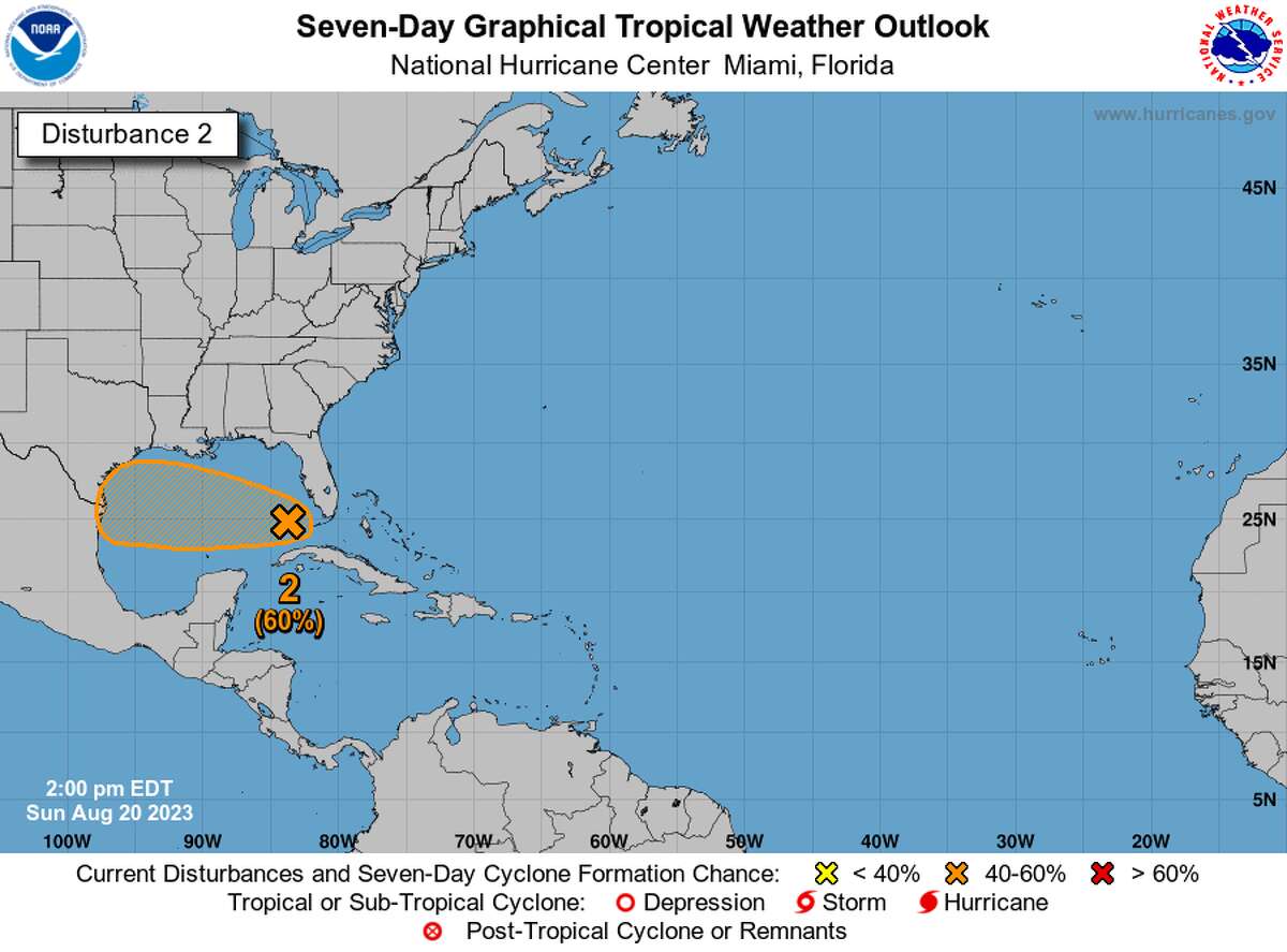
The hurricane season in the Atlantic Ocean has started to “wake up” with multiple tropical waves recently developing. The National Hurricane Center has highlighted an area of concern, where a tropical low was north of the western tip of Cuba on Sunday but moving deeper into the Gulf of Mexico toward Texas. Showers and thunderstorms in relation to the tropical low have increased, forecasters said.
“Additional development of this system is possible as it moves westward at about 15 to 20 mph, and a tropical depression could form as it approaches the western Gulf of Mexico coastline by Tuesday,” the hurricane center said in a bulletin, adding that the low had an 80 percent chance of becoming something stronger and more organized in the coming days.
Although Monday’s forecast for San Antonio calls for the now-familiar mix of sunshine and a high near 104 that feels more like 107 because of the humidity, the city has a 30 percent chance of overnight rain.
Then on Tuesday, the weather service outlook includes a 70 percent chance of rain, cloudy skies and temperatures staying below 95 degrees all day. Precipitation is likely, but just how much we get is uncertain.

The National Hurricane is monitoring an area of tropical activity in the Gulf of Mexico that could bring rain or at least milder temperatures to South Texas this week.
National Hurricane CenterWhile this tropical activity may not provide drought-busting rain, it could bring some clouds and scattered showers on Tuesday that should help keep us from extending this year’s record streak of consecutive 100-degree days.
Looking at San Antonio’s weather records, which go back to the 1880s, the record for consecutive 100-degree days had been 21 days, set in 1962. Last year, the city had as many as 14 days in a row of triple-digit temperatures. But on Sunday, San Antonio set a new record: hitting or exceeding 100 degrees for the 22nd day in a row.
Certainly, even though the rain potential might be low, anywhere from between a tenth to a quarter of an inch, any amount of rainfall can be beneficial for the ongoing drought. According to the latest data from the U.S. Drought Monitor, at least 71 percent of Texas is under moderate to exceptional levels of drought, affecting 22 million of the state’s 29 million residents.
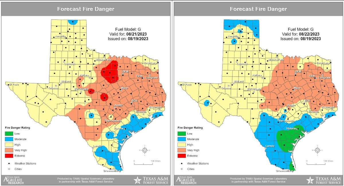
The lack of rain and excessive heat has made for a particularly active wildfire season across Texas. According to the Texas A&M Forest Service, more than 500 wildfires have been reported so far this month, and that’s about 150 percent above average. They say a high volume of wildfire activity is expected Monday because of extremely dry vegetation, intense heat, and dry conditions.

The Texas A&M Forest Service says a high volume of wildfire activity is expected Monday because of extremely dry vegetation, intense heat, and dry conditions.
Texas A&M Forest ServiceWildfires can be erratic and dangerous but you can help diminish the threat and the spread by following these tips:
- Create a defensible space around your home by clearing brush away.
- Do not toss lighted cigarettes on the ground.
- Do not drag tow chains on the ground or roads.
- Park vehicles in designated areas and not over dry grass.
- Follow the burn bans.
Remember that wildfire can be unpredictable, so it’s crucial to prioritize your family’s safety. Always say informed and prepared for potential emergencies.
"low" - Google News
August 21, 2023 at 04:04PM
https://ift.tt/veiVYal
San Antonio weather: Tropical low in Gulf nears, rain on the way - San Antonio Express-News
"low" - Google News
https://ift.tt/DvkGcWq
Bagikan Berita Ini


0 Response to "San Antonio weather: Tropical low in Gulf nears, rain on the way - San Antonio Express-News"
Post a Comment