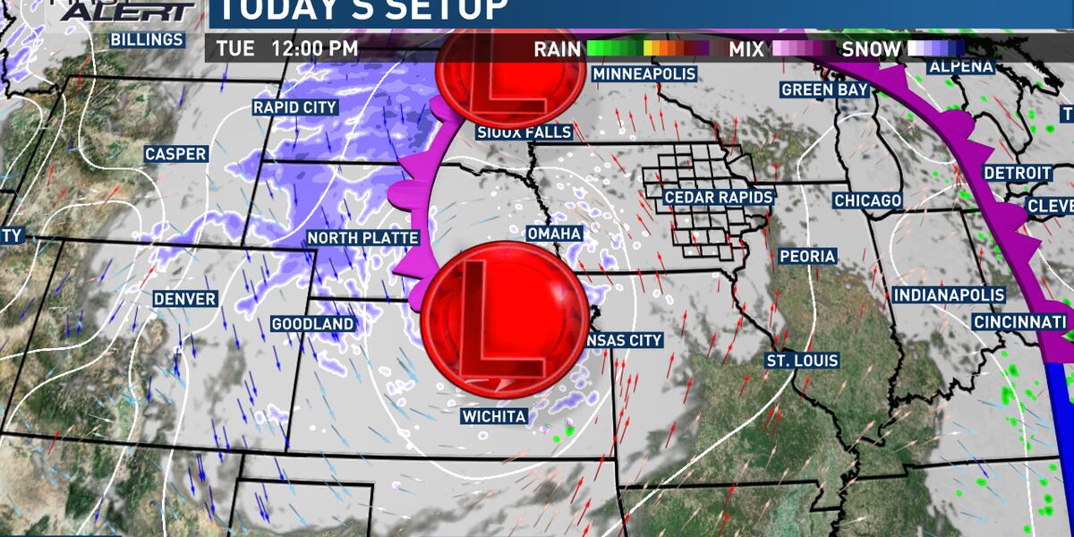
CEDAR RAPIDS, Iowa (KCRG) - Precipitation remains a possibility until a complex low pressure system exits the region, which will still take a couple of more days.
A decent southerly breeze is out there today, providing wind chills in the mid to upper 20s. While this isn’t too unreasonable for late December, it is a pretty big shift from the past couple of days. Highs today only reach the mid to upper 30s at best, and wind chills could have trouble making it out of the upper 20s at our warmest.
One thing that hasn’t changed much from the holiday weekend is the extent of the cloud cover today, though we have at least a chance of seeing some patchy clearing break out temporarily. Those breaks will be hard to come by, and will be short-lived if they exist. A few areas of light rain or drizzle are possible in the morning in cloudy areas, with some scattered rain or snow showers possible as the day goes on. Many areas will remain dry, but those that do experience them will get a brief period of reduced visibility.
Those showers diminish for most later this evening into the start of the night, but additional precipitation becomes a threat late tonight into tomorrow. This comes mainly in the form of some snow showers, but a little bit of rain could mix in at times. It also mainly affects the southern half of the viewing area, with locations along and south of the U.S. Highway 30 corridor having the best shot at seeing this activity. Some minor snow accumulation could occur, though this will be fighting against warmer air and ground temperatures. Highs will again be in the mid to upper 30s after lows in the upper 20s to low 30s.
We all catch a break from additional precipitation tomorrow night, with some partial clearing as well. Temperatures dip into the upper 20s for most. A batch of some rain or snow could move through later in the day, with the eastern half of the TV9 viewing area more favored to see any of this. It’s another time period where amounts stay generally light. Highs hit the upper 30s.
The area of low pressure causing this extended stretch of active weather finally exits the region by Thursday night into Friday, giving us a handful of drier days. Initially, temperatures won’t change a whole lot on Friday, with highs in the upper 30s to low 40s, and lows in the upper 20s. But, a cold front moves through on Saturday to change things for a bit. While it likely passes without much in the way of precipitation, highs by New Year’s Eve will be in the upper 20s to low 30s, with lows in the upper 10s to low 20s for late-night celebrations of the new year.
A quick bounce back toward the upper 30s is likely by the middle of next week, as we kick off 2024 with above normal temperatures.
Copyright 2023 KCRG. All rights reserved.
"low" - Google News
December 26, 2023 at 06:51PM
https://ift.tt/j1EKa4L
Threat for some rain, snow continues with low pressure nearby - KCRG
"low" - Google News
https://ift.tt/qwvbfYT
Bagikan Berita Ini


0 Response to "Threat for some rain, snow continues with low pressure nearby - KCRG"
Post a Comment